 |
|
 |
|||||||
Raw data of the weather radar for the broader area of Athens are available since 2005.

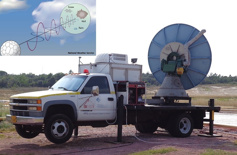
Weather radar is currenty the only measurement system which can provide real-time detailed information for storms. XPOL is a modern mobile Doppler polarimetric X-band weather radar, which provides high resolution spatial-temporal rainfall maps with a typical range of 120 km. It was made in cooperation with National Center for Atmospheric Research, USA.
Status: operational
Read more/less
The basic installation site of the radar is at the location of Institute of Environmental Research & Sustainable Development (IERSD) in Palaia Penteli, Athens, where it operates during time periods of storms in the broader area when it is not participating in research projects in other areas. This site is not optimal for radar operation due to obstacles in many directions (especially in the sector North-East-South), but it is the only available by IERSD for long-term installation.
The raw radar measurements are processed with algorithms developed by IERSD and rainfall rate, 1 hour accumulated rainfall and wind (in rain areas) maps are shown in this web page in nearly real-time. This information is valuable for more accurate nowcasting of flash-floods. The nowcasting is extended up to 6 hours ahead after assimilation of radar data in a weather forecasting model (see Nowcast page).
The radar does not cover the sector North-East-South due to obstacles in these directions.
|
|
|||
|
Institute of Environmental Research & Sustainable Development National Observatory of Athens I. Metaxa & V. Pavlou, 15236 Palaia Penteli Athens, Greece |
Page last modified: August 4,2024
|
||

